(Thought)
When was the last time you looked up the sky and wondered at the clouds? Not only at their shapes that can resemble many things and inspire children and future tellers, but at their height and size and thickness, structure and movement. You can discover a whole new world in the clouds, which are the actors in the theater of weather. You don’t need a degree to enjoy watching clouds, you just have to look up any time during the day or night. I discovered this world during my meteorology training at the British Antarctic Survey, and since that there is no day, when I wouldn’t watch the sky and I don’t understand how did I miss it until now. I’m just an amateur, but I might be able to infect you with my enthusiasm towards clouds. Don’t miss it.
What’s the fun in it
Clouds can be nice. At least most people find them visually pleasant. Nothing is easier than getting likes on Flickr with cloud photos. But that won’t keep you watching them every day unless you get knowing them better. When you can distinguish the cloud layers and types, when you follow them forming and reforming, when you see how the wind moves them, how the sun and moon lights them, that is when you will be bound to them forever. It is said Englishmen always speak about the weather. Now, if you have some friends, who appreciate the clouds same as much as you, then you will be more Englishmen than any English man. Discussing the clouds on the sky, arguing about what type they are, how high they are is a good game, believe me. Calling them by their Latin names can either seem cool, hilarious or frustrating to others, but when you can tell if rain comes, or the night will be cold and the grass will be wet in the morning, that is always handy and respected.
- Not convinced? -> At least have a look at the pictures.
- Convinced? -> My man. Read on.
Cloud formation
So let’s say you are a water molecule, H2O according to the chemists. You are not even a drop in the sea, you are just a drop in a drop. But one day the sun shines on you and you evaporate. You fly! You fly up in the air. You are moisture now. Not a big thing, but you can already create rainbow and make people breathe heavily. Now it is time to cooperate, the more mates you have the more moisture the air is and the higher the dew point get. The aim is to increase the dew point above the actual temperature, then you and your mates can vapor and create dew. You are tiny nice visible drops now floating in the air. If you vapor at the ground you are called mist or fog, if you vapor higher you can form a water cloud, and if you vapor high above, you freeze and form a beautiful ice cloud. Just be careful, ambitious drops like you emerging higher and higher can grow heavier than the air can bear and fall back to the ground level in form of rain, snow or ice. But don’t be too afraid, you can always start the cycle again.
Cloud layers
Clouds have different characteristics in different heights, therefore they have been categorized by diligent scientists, who even were kind enough to create some rules of thumb for the us mortal ones.
- The low-level clouds are either large puffy units or one uniform sheet covering the sun and moon and they tend to generate precipitation too. They form in up to 1800 m (6000 ft) height above the ground, which is quite low in fact: little birds and para-gliders fly in that heights, you can even walk up to a mountain and look down on these clouds.
- The mid-level clouds are water clouds similar to the low-level ones, but in much bigger heights: up to 7 000 m (23 000 ft). You have to sit on a jet if you want to look down on these ones. The puffy types are small, and the sheet clouds are opaque, you can see the disk of sun or moon across them.
- The high-level clouds are stretching to the top of the troposphere: 10 000 m (33 000 ft), as high as the commercial jets can climb. They are always formed by ice particles, their boundaries are less structured as the water clouds, their material is thin, veil-like. The puffy ones are very small, the sheets are misty, you can see the blue sky through across them.
You can distinguish the cloud levels many ways. For example by using your hand as a standard: if the cloud look bigger than three fingers at the end of your stretched arm then they are low-level clouds, if they are bigger than one finger then they are mid-level clouds, the even smaller ones are high-level clouds. You can also do the opacity test: low-level sheet clouds let only the scattered light through, but if you can see the sun disk, then they are mid-level clouds, if you can even see the blue sky through them, then they are high-level clouds. Low level clouds also tend to look darker than higher level clouds, that are the higher the whiter. Also, the faster they seem to move the lower they are: on a windy day it is very easy to see the different layers. Sunrise and sunset separate layers too: the higher clouds are the ones that are illuminated for the longer time. The high-level clouds can reflect red light hours after the sun disappeared on the horizon.
Cloud names
The easiest way to scare away people from meteorology is to speak to them in Latin. It is an incomprehensible, dead language kept half-alive by priests, scientists and wizards, so what is the point? On the other hand, it can be an endless fun to show off with it. So it is up to you whether you read this section or jump to the next one, you won’t need it for understanding the rest. But cloud names are extremely simple. So why not give it a go?
There are only three very basic types:
- stratus = layer: uniform sheet of misty cloud
- cumulus = accumulation: puffy fair weather cloud
- cirrus = curling: wispy veil-like ice cloud high up in the air
And there are some variants:
- stratocumulus = layer accumulation: half-way between puffy and sheet cloud
- nimbostratus = raining layer: dark sheet cloud that tend to produce intense rain
- cumulonimbus = raining accumulation: dark puffy storm cloud
- altostratus = high layer: same as stratus just higher in the air
- altocumulus = high cumulus: same as stratus just higher in the air
- cirrostratus = curling layer: ice cloud sheet
- cirrocumulus = curling accumulation: puffy ice cloud
Cloud recognition
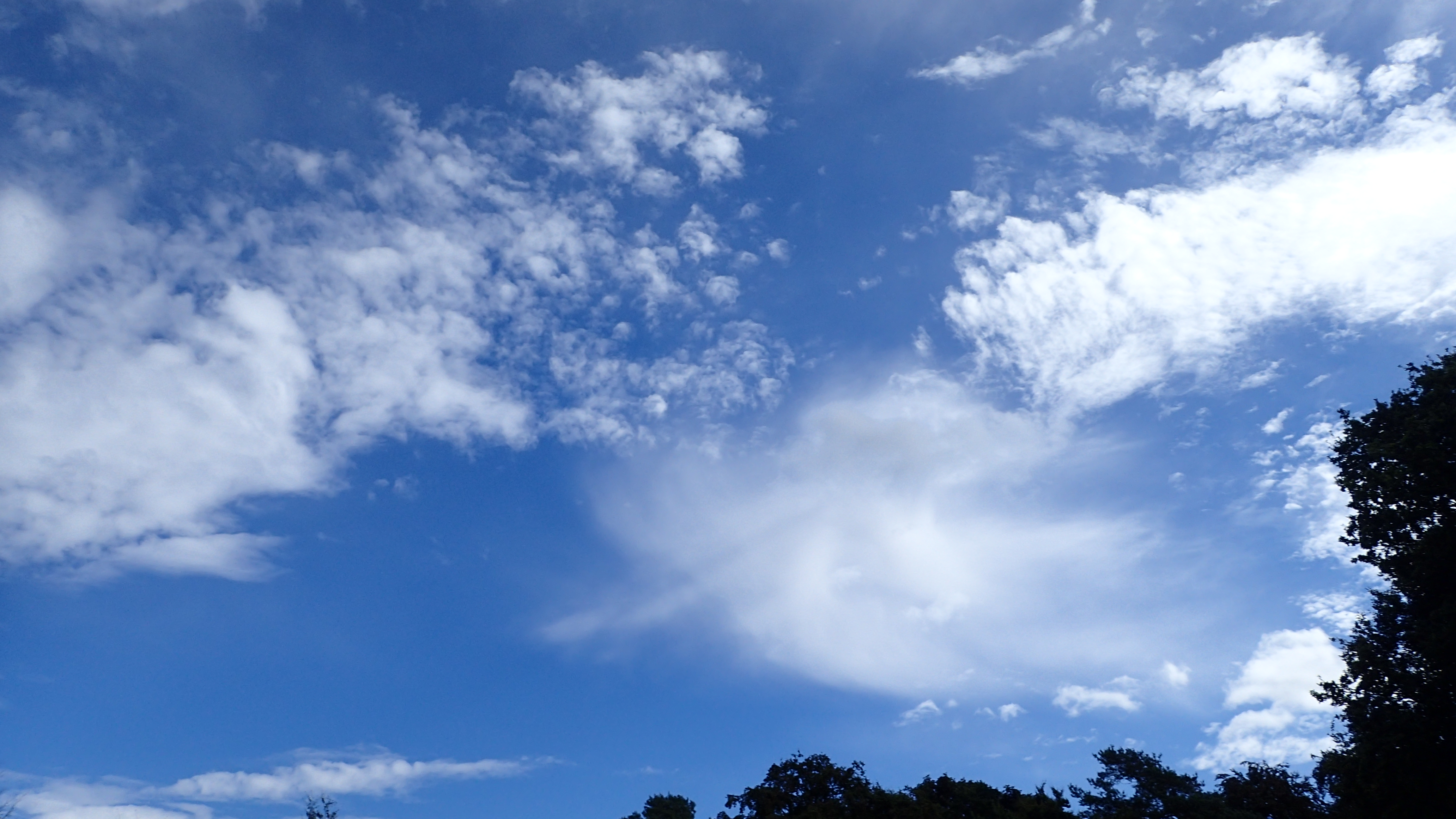
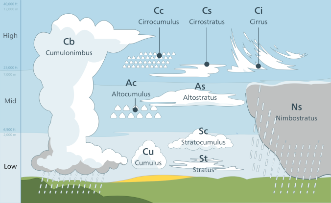
So here are some examples for typical cloudy skies. The first picture below was taken in Cambridge. In the bottom left corner you can see a bunch of flat, puffy, dark clouds, which are typical low-level clouds, built up of large units, moving quickly on the sky. They are most likely stratocumulus clouds. The top right corner however is very different. It is filled with a uniform cloud layer through which the sun disk is still visible and the whole sheet seems to be in the background of the puffy clouds, so it must be in bigger heights, and it is likely to be a mid-level sheet cloud called altostratus. The high-level clouds, if there are any are not visible, so we cannot tell about them without flying over that sheet.
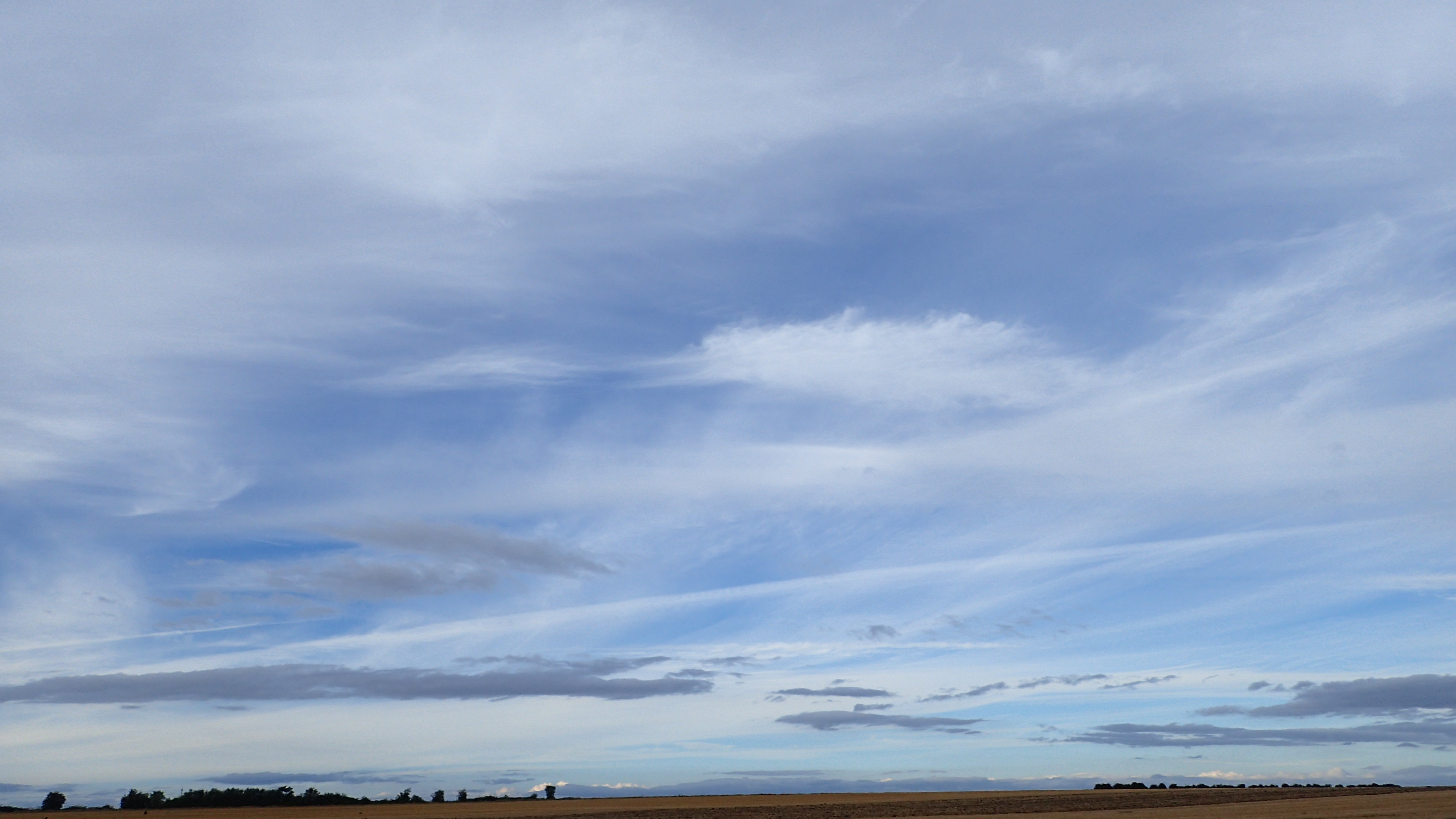
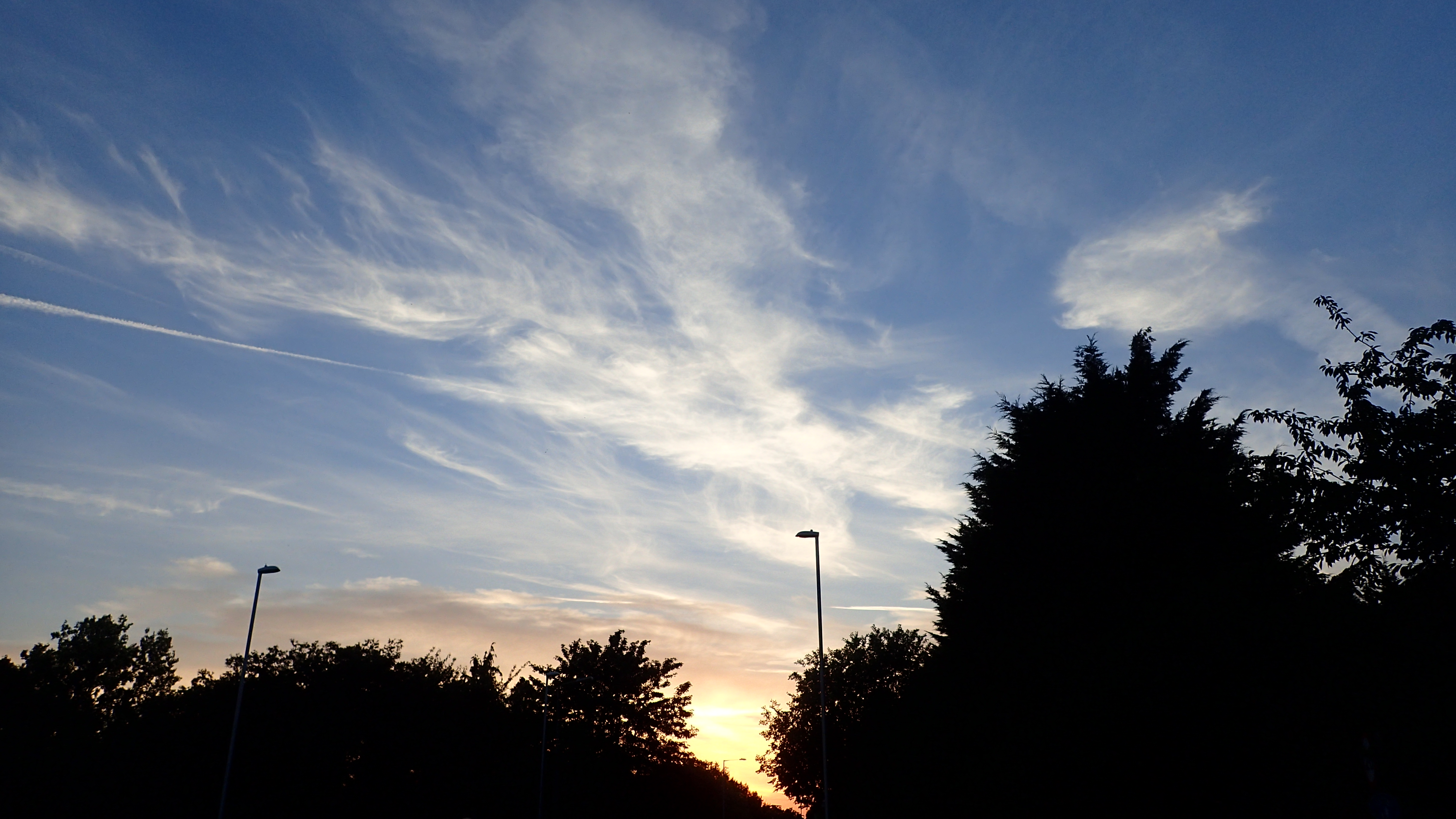
A very different sky captured above Girton a few weeks ago. The top half of the picture is full of little puffy clouds. They are most likely in the middle layer, otherwise they would be even smaller and their boundaries would be less structured. So they definitely look like altocumulus clouds. The thin, white veil fragment in the middle is a tricky one. It might look like a high level sheet cloud, but even on the picture it can be seen that it is in front of the little puffs. On the site we would also see that it is moving quickly, so consequently it is a low-level cloud, possibly the remaining of a stratus fragmented by the wind and the sun (also called stratus fractus). There are no visible high-level clouds on this picture.
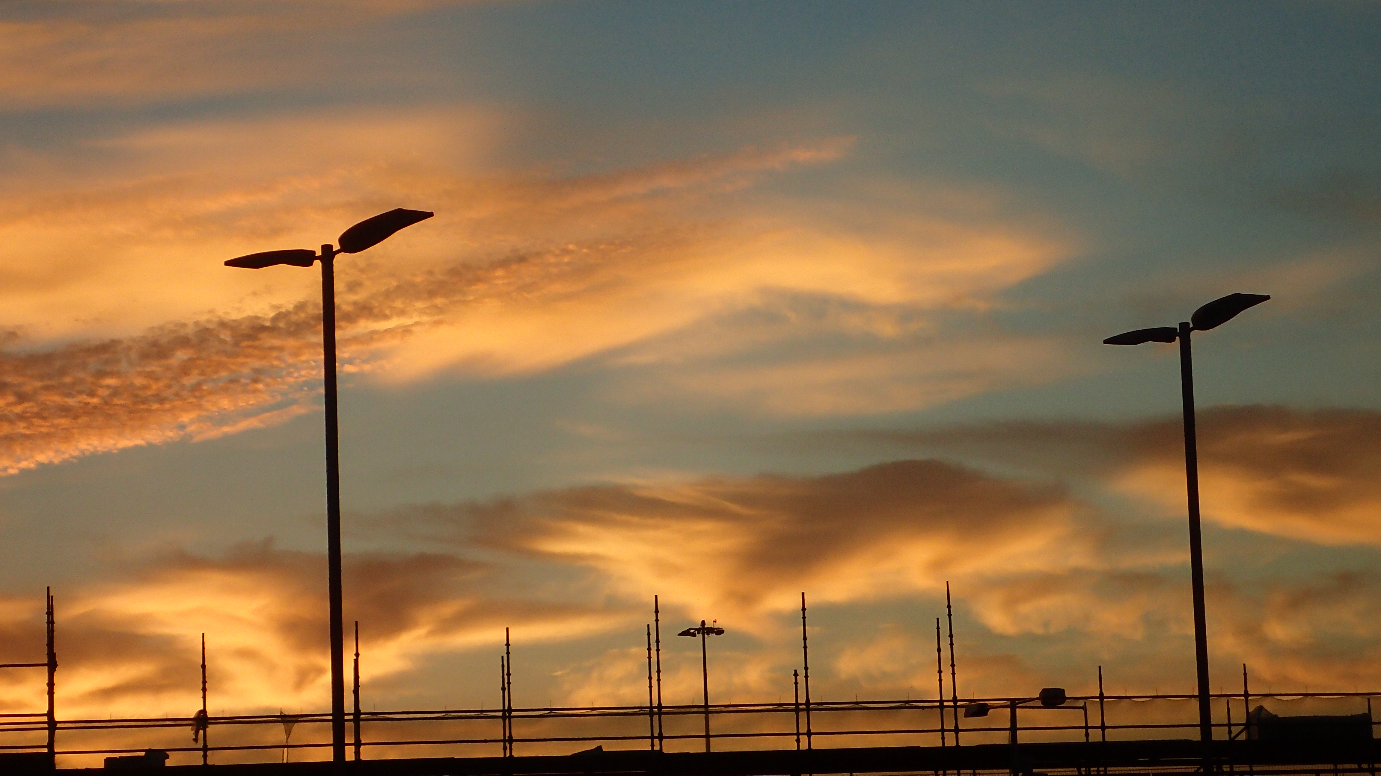
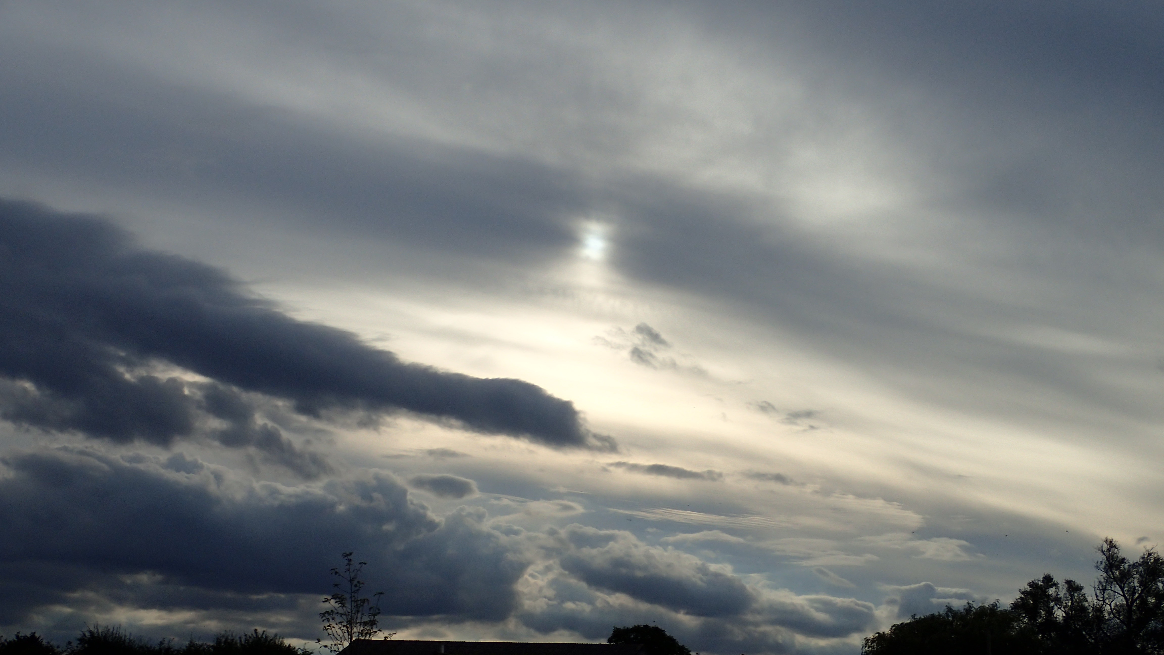
This sunset sky was captured at the same place a day later, but see how different the sky is. It is dominated by thin, curly and veil-like clouds with soft boundaries, still highly illuminated by the setting sun. They are typical high level clouds, mainly cirrus and some cirrostratus. In the bottom of the picture just above the tree line you can see some darker, puffy clouds. Both their shape and color is very different from the high-level clouds. They might be cumulus or stratocumulus.
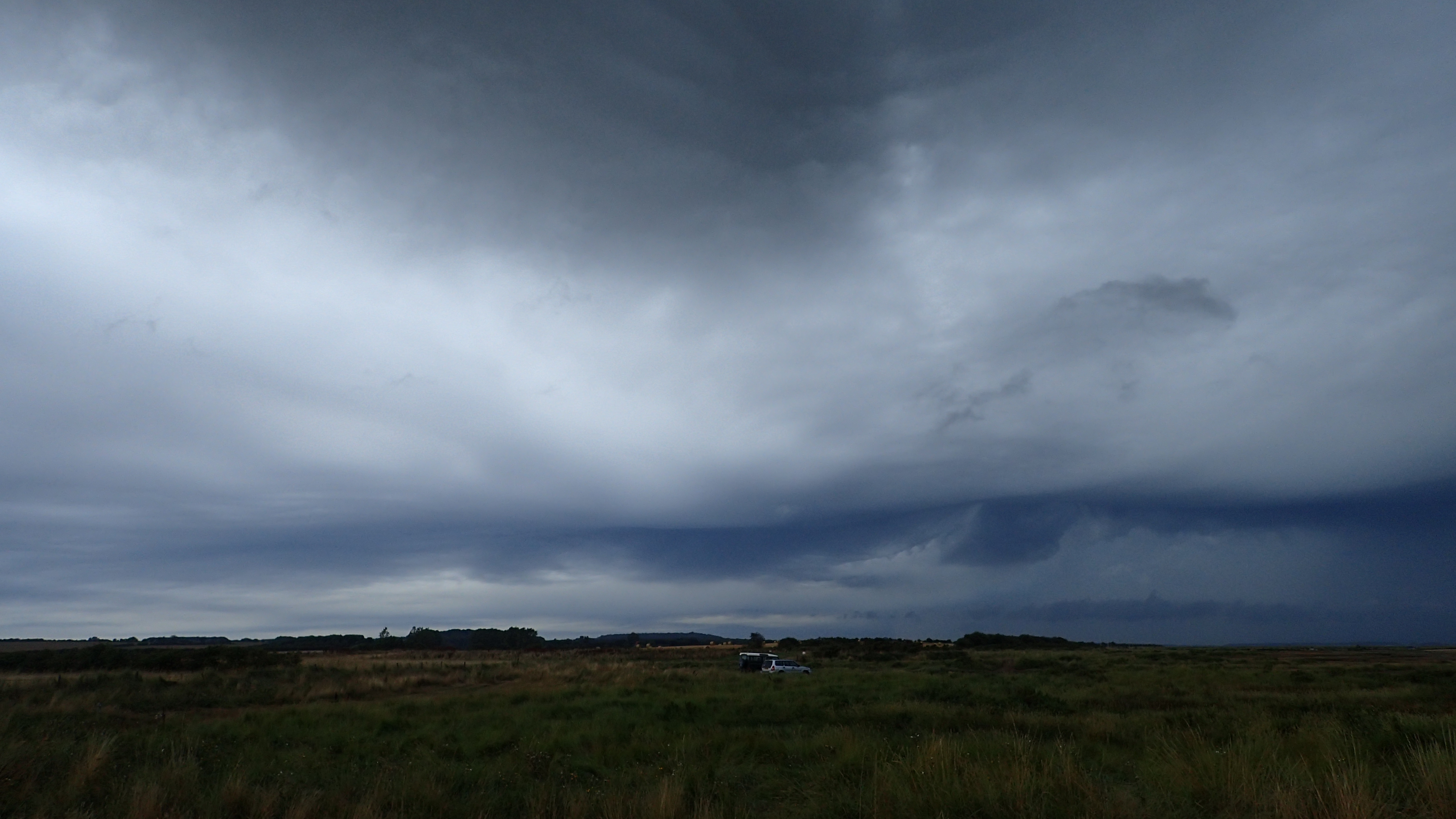
And finally the king of clouds: a huge storm cloud (cumulonimbus) captured at the shore of Norfolk from below. I walked almost an hour making several photos of this beast as it formed and invaded the sky. Half an hour later I was caught in a shower, lightnings were striking around me and the wind was blowing wildly. It lasted for about an hour and then stopped for good. If you see it you won’t miss it.
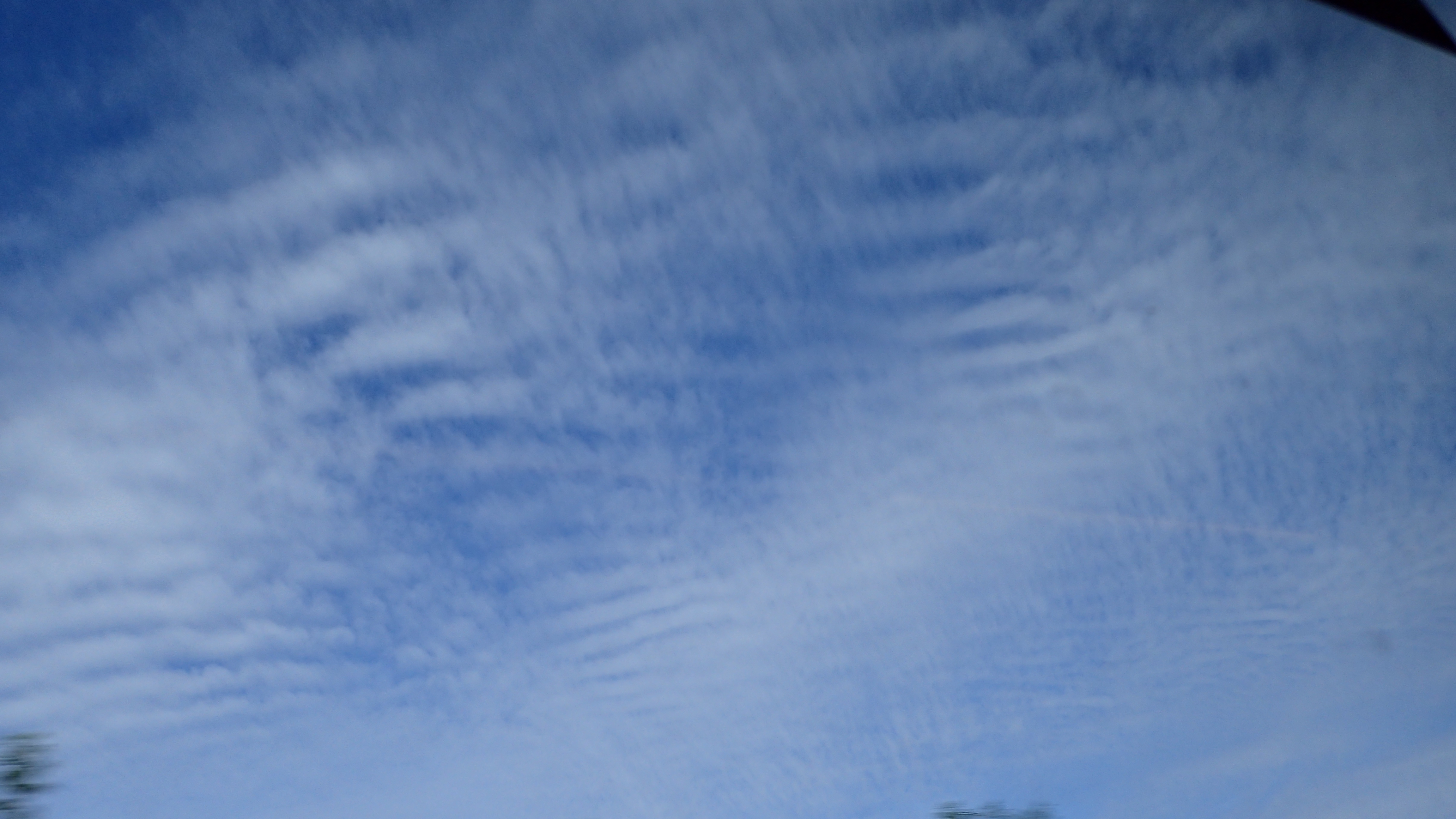
Gravity waves on clouds
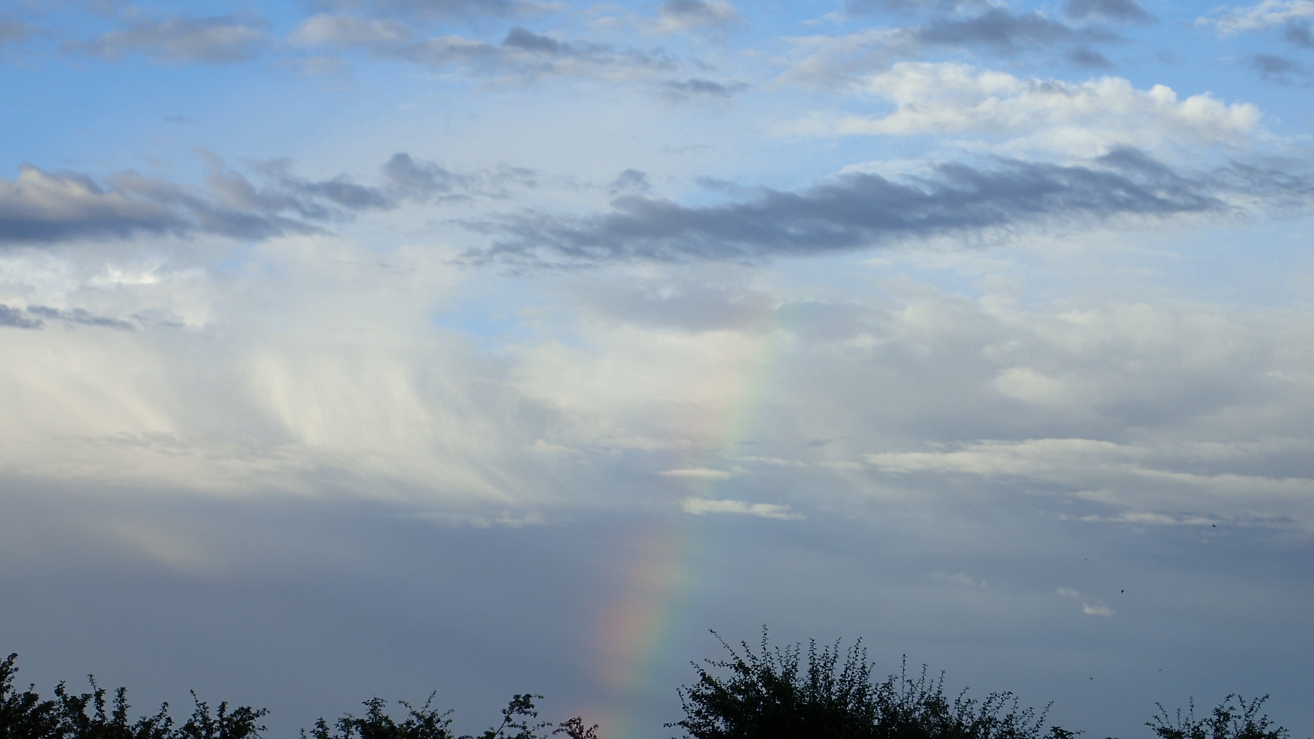
You might see this special phenomenon sometimes. It has no relation to the gravitational waves you might have heard of recently, rather related to the normal sea waves, but these are formed by the air rising and falling as it goes. Gravity waves can appear above terrain features or can be generated by water waves. They become visible on the bottom of the clouds, especially low-level sheet clouds (stratus) as you can see on the picture below. They aren’t freqent and mostly they can be spotted only on a small part of a cloud, so you will be glad if you find one.
I hope this short introduction to clouds raised you interest. In this case you might want to visit some of the more professional sites like the ones below:
- UK MET office: Cloud spotting guide
- National Weather Service: Ten basic cloud types
- The Cloud Appreciation Society
- Cloudspotter app in cooperation with NASA
Take care and watch up.

Pingback: Ready for Antarctica | GABOR|GEREB